
2021 Adventures
OHV Rider Resources For Minnesota and Beyond
Year after year, the most common question fielded by off-highway vehicle (OHV) clubs and rider groups on social media is “Where can I ride?” The second most common question is “Where else can I ride?”
Traffic on the OHV trails in Minnesota grew rapidly in 2020, as the state’s Stay-At-Home order got families searching for new outdoor activities. OHV sales (ATV, ORV, OHM) accounted for over 24,000 new registrations in Minnesota last year. Now is a great time to plan day trips, weekend rides and week-long vacations.
Here is a roundup of websites, maps and apps to help you get started.
MN DNR OHV Trail Atlas
Cost: Free
Details: 80 pages, 70 OHV State Trail maps, descriptions, directions to parking and more.
Order by email:
MN DNR OHV Trail Maps, Printed
Cost: Free at www.dnr.state.mn.us/ohv
Details: Print individual Trail Atlas maps, from the A-Z list or state map, also an interactive map.
MN DNR OHV Trail Maps, digital
Cost: Free
Details: On the Avenza App, search the map store: MNDNR + (trail name). Geo-referenced pdf maps.
Also: State Forest maps show camping and more. Search: MNDNR + (forest name).
New! Motorized Recreation Visitor Maps, Superior National Forest
Cost: Free
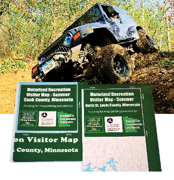
Details: Unfolded 2’ 3” x 3’ 3”, shows legal routes on GIA State Trails, roads and routes on county, state and federal public lands open to registered ATVs, ORVs, and OHMs. One map shows Cook County, Lake County on reverse. Second map shows North St. Louis County, South St. Louis on reverse.
Available at: DNR St. Paul office, Area Offices in Tower and Two Harbors. Chamber offices in Ely, Orr, International Falls, Two Harbors, Silver Bay, Grand Marais, Iron Range Tourism Bureau in Eveleth. Superior National Forest office in Duluth, District Offices in Ely, Cook, Aurora, Tofte and Grand Marais.
Digital versions: On Avenza App map store. Geo-referenced, shows rider location on smartphone or tablet. Works without cell coverage. Map titles are: “CRTU Superior National Forest Summer: (County Name).” CRTU mapping project made possible through a partnership with the Superior National Forest, Minnesota DNR Parks & Trails, and the three Counties. Major funding provided by Yamaha and Polaris grants, and taxes from the Minnesota Mining Industry.
Motorized Vehicle Use Maps (Superior/Chippewa National Forests)
Cost: Free at Forest and District Offices, and online at Forest websites.
Details: Printed MVUMs show federal Forest Roads open to all vehicles including OHVs, and those open only to Highway Legal Vehicles. Official document regulating motor vehicle use on National Forests. Note: MVUM may show only routes on federal lands, and not routes that continue onto state and county lands. MVUMs available from most National Forests, printed and online.
ATV Club Trail Maps
Many ATV Minnesota member clubs have printed maps for the trail systems they have built and maintained. Check club websites and Facebook pages for availability.
Websites, Maps and Apps for OHV Trails Nationwide
Ride Command
Cost: App is free on App Store and Google Play.
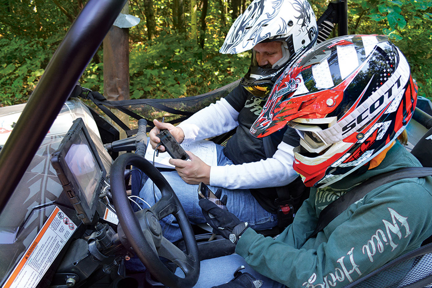
Details: Shows GPS location on OHV trails, routes open by vehicle type, rider resources; tracks and saves rides to computer account with 3D flyover view. Group Ride shows the location of multiple riders on trails. Community feature shares rider tracks, publicizes club rides, events. In-vehicle display is available as standard feature or accessory for many Polaris models.
Website: ridecommand.polaris.com
Avenza Maps
Cost: “Almost a million free and paid maps.” Including Minnesota State Trails, Forests.
Details: Available on App Store and Google Play. Upload geo-referenced pdf maps of trail systems and areas across U.S. Utilized by USFS and BLM to provide MVUMs and travel plans.
Website: avenza.com
Gaia GPS
Cost: Free or $36/year premium plans.
Details: Available on App Store and Google Play. “Know what to expect from the 4x4 roads ahead with topo maps from USGS and USFS, overlaid with motor vehicle use restrictions, property ownership, and more. Find new legal dispersed campsites for cars, trucks, and trailers by easily viewing public land designations like BLM and National Forest along with ownership of individual parcels.”
Website: gaiagps.com/offroad
OnX Offroad
Cost: $29.99/year
Details: Available on App Store and Google Play. “Explore more than 350,000 miles of open roads and trails and 985 million acres of public land.”
Website: onxmaps.com/offroad-app
TrailForks
Cost: Free
Details: Available on App Store and Google Play. “Trailforks is a trail database, map & management system for users, builders and associations. A platform for trail associations to keep track of trail conditions, builders to log work and users to discover, plan and share their activities.”
Website: trailforks.com
Rider Planet
Details: A directory of popular ATV trails, dirt bike trails, scenic OHV and UTV routes, and motocross tracks in the U.S. Partial list of trails in Minnesota.
Website: riderplanet-usa.com
US Forest Service National Overview Maps
Cost: Free
Details: “We’ve released the next generation Interactive Visitor Map! Visitor Map 2.0 provides the public with an online view of Forest Service roads, trails, recreation sites, wilderness areas, and wild & scenic rivers.”